 |
MALI RIVER NIGER AND THE DOGONS |
| |
|
|
![]()
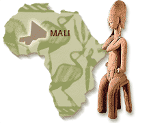
The wealth of this trading was based primarily on the taxes levied on the transport of West African gold to North Africa and the Middle East, and of salt caravans. A long series of powerful empires grew up and collapsed in this part of the world, from the 9th to the 16th century. They only came to an end following invasion from Maroc and the breaking of the Muslim monopoly on trade in Africa and the Indian Ocean by the European maritime nations. Toward the end of the 19th century, Mali became a french colony. As in other french colonies, its people were gradually forced into cultivating cash crops initially through a system of forced labour, then later by taxation. It became independant in 1960, trough for a few month it was federated with Senegal. The first democratic president was Modibo KEITA, quickly put his country on a socialist road to development and opposed french imperialism. In 1962, Mali left the Franc Zone and set up its own currency (but came back in 1967). State corporations were set up and industrialisation was encouraged. However, some few years later, mismanagment and excessive bureaucracy forced the government to announce austerity measures wich the general public were very reluctant to accept since there was a lot of obvious profiteering going on. KEITA was overthrown in a bloodless military coup in 1968 and the country has been ruled by the leaders of that coup ever since. The military are not particularly popular and the regime has been challenged on a number of occasions by student and labour organisations. The death in detention in 1977 of KEITA, in particular, provoked spontaneous demonstrations throughout the country. Being a part of the Sahel, Mali suffered disastrously from the droughts of the 1970s. The drought turned enormous areas of once marginal grazing and crop raising land into desert and resulted in massive losses of crops and livestock. When a further drought struck 1984-85, not only were emergency supplies of grain help up in the ports of Dakar, Abidjan and Lome but when they finally arrived in Mali, the nomads of the country's vast northern region were beyond reach. The roads and other transport infrastructure simply did not exist. Some 80 % of the cattle wich they depend perished and the nomads themselves were decimated. A crisis became between nomads and the rest of the population. This tension explode in 1990, and the fights will pursue up until 1992. Today, the nomad's rebellion is a bad memory, and this country live in political stability. After cotton's production, tourism is an important development's factor.
|
![]()
| OK Raids -
okraids@okraids.bf Tél : (226) 50.38.88.63 / 96 Fax : (226) 50.38.55.46 |